File:Campestrem Regionem Labelled Map.png
Size of this preview: 800 × 400 pixels. Other resolution: 1,920 × 960 pixels.
Original file (1,920 × 960 pixels, file size: 2.72 MB, MIME type: image/png)
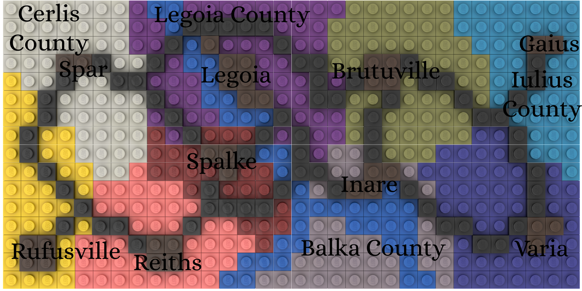
A Map of the NRR Colonial Counties (same as EotLP counties) labelled with County Seats as well
File history
Click on a date/time to view the file as it appeared at that time.
| Date/Time | Thumbnail | Dimensions | User | Comment | |
|---|---|---|---|---|---|
| current | 03:25, 30 April 2026 | | 1,920 × 960 (2.72 MB) | JabicAdmin (talk | contribs) |
You cannot overwrite this file.
File usage
The following page uses this file: